اشتہارات
انسانی تاریخ کی پیچیدہ ٹیپسٹری میں، دنیا کے بارے میں ہماری سمجھ کو نقشہ کے طور پر تشکیل دینے میں چند ٹولز نے اتنا ہی اہم کردار ادا کیا ہے۔ غار کی دیواروں پر ابتدائی خاکوں سے لے کر آج کے جدید ترین ڈیجیٹل کارٹوگرافیوں تک، نقشوں نے نہ صرف ہمارے سیارے کی جغرافیائی شکل کی عکاسی کی ہے بلکہ عوامی تاثر کو ڈھالنے اور یہاں تک کہ مخصوص نظریات کی تشہیر میں بھی اہم کردار ادا کیا ہے۔ یہ خاموش طاقت - یہ لطیف اثر جو نقشے کو چلاتا ہے - اکثر غیر تربیت یافتہ آنکھ کی طرف سے کسی کا دھیان نہیں جاتا ہے، پھر بھی یہ ایک ایسی طاقت ہے جتنی کسی سیاسی تقریر یا میڈیا کی نشریات میں۔ "Mapping Minds: The Power of Cartography in Shaping Public Perception and Propaganda" میں خوش آمدید، جہاں ہم کارٹوگرافی اور انسانی نفسیات کے درمیان پراسرار تعلق کو کھولتے ہیں۔
اشتہارات
نقشے صرف جسمانی خالی جگہوں کی بصری نمائندگی سے زیادہ ہیں۔ وہ طاقت، اختیار اور ارادے کی داستانیں ہیں۔ جب آپ نقشہ کھولتے ہیں، تو آپ صرف لکیروں اور علامتوں کی ترتیب کو نہیں دیکھ رہے ہوتے۔ آپ نقشہ ساز کے ذریعہ تیار کردہ کہانی کے ساتھ مشغول ہیں۔ کیا شامل کرنا ہے یا چھوڑنا ہے، خطوں کو رنگنے کا طریقہ، اور یہاں تک کہ استعمال شدہ پروجیکشن سبھی جان بوجھ کر فیصلے کرتے ہیں جو اس بات پر اثر انداز ہو سکتے ہیں کہ ہم دنیا کو کیسے دیکھتے ہیں۔ یہ فیصلے کسی خطے کی اہمیت کو بڑھا یا کم کر سکتے ہیں، علاقائی حدود کے بارے میں رائے کو واضح طور پر رہنمائی کر سکتے ہیں، اور موجودہ طاقت کی حرکیات کو تقویت یا چیلنج کر سکتے ہیں۔ جیسا کہ ہم نقشہ نگاری کی بھرپور تاریخ کا جائزہ لیں گے، ہم یہ دریافت کریں گے کہ قدیم سلطنتوں سے لے کر جدید دور کی جغرافیائی سیاسی حکمت عملیوں تک نقشوں کو قائل اور کنٹرول کے آلات کے طور پر کیسے استعمال کیا گیا ہے۔
اشتہارات
نقشوں کی رغبت ان کی جذبات کو ابھارنے اور عمل کی ترغیب دینے کی صلاحیت میں بھی ہے۔ پوری تاریخ میں، نقشوں کا استعمال لوگوں کو اسباب کے پیچھے اکٹھا کرنے، تلاش کی چنگاری، اور یہاں تک کہ تنازعات کو بھڑکانے کے لیے کیا گیا ہے۔ غور کریں کہ جنگ کے زمانے میں پروپیگنڈے کے نقشے کس طرح قومی فخر کو بھڑکانے یا دشمن کو شیطان بنانے کے لیے تیار کیے گئے تھے، اکثر جغرافیائی سچائیوں کو ایک بیانیہ پیش کرنے کے لیے موڑتے تھے۔ اس مضمون کے ذریعے اپنے سفر میں، ہم اس طرح کے نقشوں کی پُرجوش مثالوں کا جائزہ لیں گے، ان کے ڈیزائن اور ارادے کو الگ کرتے ہوئے ہیرا پھیری اور محرکات کو ظاہر کرنے کے لیے۔ ہم دوسری جنگ عظیم، سرد جنگ، اور دیگر اہم ادوار کے دوران استعمال کیے گئے نقشہ نگاری کے حربوں کو دیکھیں گے، اس بات کا تجزیہ کریں گے کہ انھوں نے عوامی رائے کو کس طرح تشکیل دیا اور سیاسی ایجنڈوں کو متاثر کیا۔
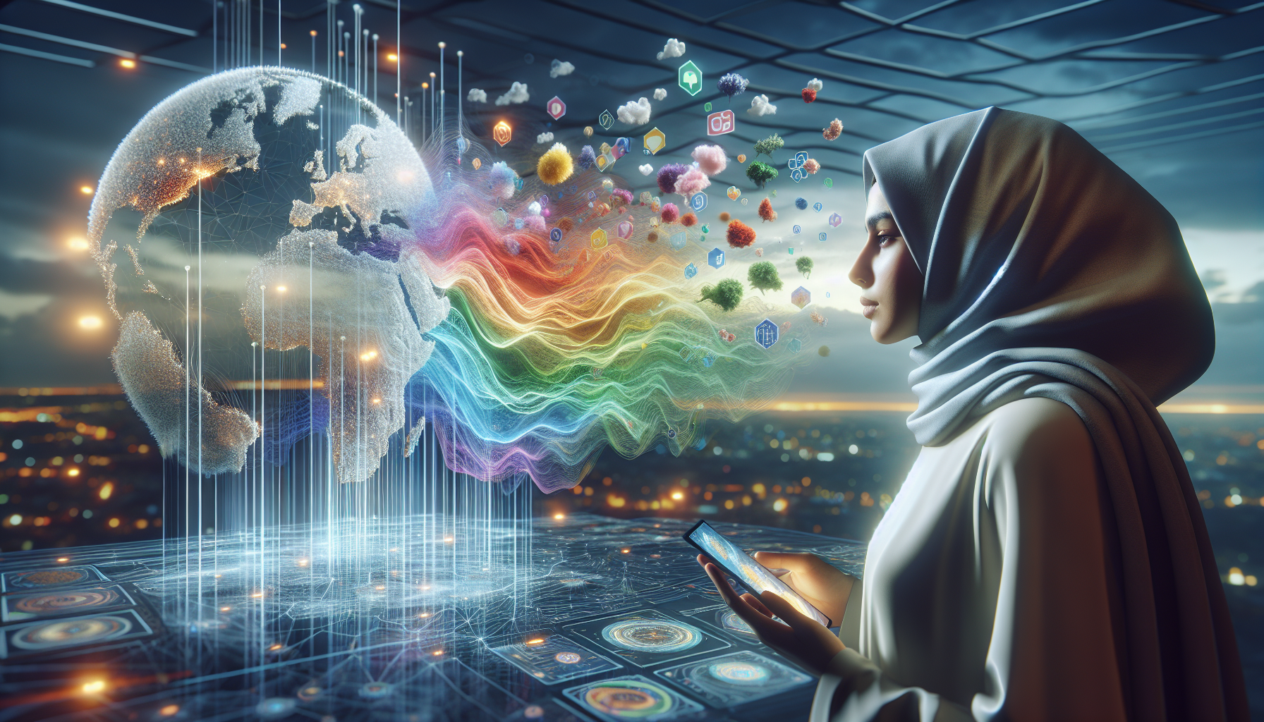
ایک ایسے دور میں جہاں ڈیجیٹل ٹیکنالوجی دنیا بھر کے نقشوں تک فوری رسائی کی اجازت دیتی ہے، کارٹوگرافک اثر و رسوخ کا امکان پہلے سے کہیں زیادہ ہے۔ ایک سادہ کلک یا تھپتھپانے سے، ہم براعظموں کو عبور کر سکتے ہیں، دور دراز کی زمینوں کو تلاش کر سکتے ہیں، اور یہاں تک کہ حقیقی وقت کی تبدیلیوں کا مشاہدہ کر سکتے ہیں۔ تاہم، یہ سہولت اس کے اپنے چیلنجوں اور ذمہ داریوں کے ساتھ آتی ہے۔ جیسا کہ ہم اپنی کھوج کا اختتام کریں گے، ہم اپنی توجہ ڈیجیٹل دور کی طرف موڑیں گے، جدید نقشہ سازی میں شامل اخلاقی تحفظات اور ممکنہ تعصبات پر بحث کریں گے۔ ہم ایک ایسی دنیا میں نقش نگاری کے مستقبل پر غور کریں گے جو اعداد و شمار کی طاقت اور درستگی اور نمائندگی کی اہمیت سے تیزی سے آگاہ ہے۔ اس جامع امتحان کے ذریعے، ہمارا مقصد آپ کو ان نقشوں کی گہری تفہیم سے آراستہ کرنا ہے جن کا آپ ہر روز سامنا کرتے ہیں، اس لازوال ٹول کے بارے میں مزید اہم اور باخبر نقطہ نظر کی حوصلہ افزائی کرتے ہیں۔ 🌍🗺️
کارٹوگرافی کی بنیادی باتوں کو سمجھنا
نقشہ نگاری، نقشہ سازی کا فن اور سائنس، صدیوں سے انسانی تہذیب کا سنگ بنیاد رہا ہے۔ نقشوں کے ذریعے ہی ہم نئے خطوں کا خاکہ بنانے، اپنے اردگرد کے ماحول کو سمجھنے اور ثقافتوں اور نسلوں کے درمیان علم کا اشتراک کرنے میں کامیاب ہوئے ہیں۔ نقشے محض نیویگیشن کے اوزار نہیں ہیں۔ یہ دنیا کی طاقتور بصری نمائندگی ہیں جو اس بات کی تشکیل کرتی ہیں کہ ہم جغرافیائی، سیاسی اور سماجی حقائق کو کیسے سمجھتے ہیں۔
تاریخی طور پر، نقشوں کا استعمال معلوم دنیا کو دستاویز کرنے، طاقت کی حرکیات کی عکاسی کرنے، اور پیغامات کو ظاہر کرنے کے لیے استعمال کیا گیا ہے، ظاہری اور خفیہ دونوں۔ مثال کے طور پر، قدیم یونانیوں نے زمین کو فلیٹ ڈسک کے طور پر پیش کرنے کے لیے نقشے تیار کیے، جو بحیرہ روم کے گرد مرکز تھے۔ جیسے جیسے ریسرچ اور سائنسی تفہیم میں وسعت آئی، اسی طرح نقشوں کی پیچیدگی اور درستگی میں بھی اضافہ ہوا۔ وہ پیچ پر سادہ ڈرائنگ سے لے کر جدید ٹیکنالوجی کی مدد سے تخلیق کردہ پیچیدہ نمائندگیوں تک تیار ہوئے۔
نقشوں کا کام جغرافیائی نمائندگی سے آگے بڑھتا ہے۔ وہ اثر و رسوخ کے آلات ہیں، عوامی تاثر کو تشکیل دینے اور یہاں تک کہ سیاسی رائے کو تبدیل کرنے کی صلاحیت رکھتے ہیں۔ جدید دور میں، ڈیجیٹل میپنگ ٹیکنالوجی نے انقلاب برپا کر دیا ہے کہ ہم نقشوں کے ساتھ کیسے تعامل کرتے ہیں۔ GPS اور آن لائن میپنگ سروسز جیسے ٹولز نے کارٹوگرافی کو ہماری روزمرہ کی زندگی کا ایک لازمی حصہ بنا دیا ہے، جو سفری راستوں سے لے کر ریئل اسٹیٹ کی سرمایہ کاری تک کے فیصلوں کو متاثر کرتی ہے۔
عوامی تاثر کی تشکیل میں کارٹوگرافی کا کردار
نقشے کو اکثر حقیقت کی غیر جانبدار اور معروضی نمائندگی کے طور پر سمجھا جاتا ہے، پھر بھی وہ فطری طور پر منتخب ہوتے ہیں۔ ہر نقشہ انتخاب کا ایک پروڈکٹ ہوتا ہے — کیا شامل کیا جائے، کیا چھوڑا جائے، اور مختلف عناصر کی نمائندگی کیسے کی جائے۔ یہ انتخاب عوامی تاثر کو نمایاں طور پر متاثر کر سکتے ہیں۔ مثال کے طور پر، نقشے پر کسی ملک کا سائز اس بات کو متاثر کر سکتا ہے کہ اسے کتنا طاقتور سمجھا جاتا ہے۔ اس رجحان کی مثال مرکیٹر پروجیکشن سے ملتی ہے، جو خط استوا سے دور علاقوں کو بڑا کرتا ہے، جس سے یورپ اور شمالی امریکہ جیسے علاقے اپنے موجودہ سائز کے نسبت بڑے دکھائی دیتے ہیں۔
کارٹوگرافی سماجی اور سیاسی پیغام رسانی کا ایک ذریعہ بھی ہے۔ سرد جنگ کے دوران، نظریاتی تقسیم کو ظاہر کرنے کے لیے نقشوں کا استعمال کیا جاتا تھا، مغربی نقشے اکثر کمیونزم کے پھیلاؤ پر زور دیتے تھے اور مشرقی نقشے سرمایہ دارانہ تجاوزات پر توجہ مرکوز کرتے تھے۔ یہ نمائندگیاں محض معلوماتی نہیں تھیں۔ وہ اپنے سامعین سے مخصوص جذباتی اور نفسیاتی ردعمل کو جنم دینے کے لیے تیار کیے گئے تھے۔
عصر حاضر میں، موضوعاتی نقشے مختلف سماجی مسائل، جیسے موسمیاتی تبدیلی، صحت اور تعلیم کے اعداد و شمار کی عکاسی کے لیے مقبول ہو چکے ہیں۔ یہ نقشے ان تفاوتوں اور رجحانات کو نمایاں کر سکتے ہیں جو شاید خام ڈیٹا فارمیٹس میں ظاہر نہ ہوں۔ تاہم، عوامی تاثرات پر اس طرح کے نقشوں کا اثر ان کے ڈیزائن کے انتخاب پر منحصر ہے۔ رنگ، علامتوں اور پیمانے کا استعمال بعض پہلوؤں پر زور دے سکتا ہے جبکہ دوسروں کو کم کرتے ہوئے، ناظرین کی تشریح کو لطیف طریقوں سے رہنمائی کرتا ہے۔
پروپیگنڈا اور کارٹوگرافی: ایک تاریخی تناظر
پوری تاریخ میں نقشوں کو پروپیگنڈے کے آلات کے طور پر استعمال کیا جاتا رہا ہے۔ وہ مخصوص بیانیے کو فروغ دینے، علاقائی دعوؤں کو جواز بنانے اور رائے عامہ پر اثر انداز ہونے کا کام کرتے ہیں۔ تنازعات کے دوران، نقشے خاص طور پر قوم پرستی کو فروغ دینے اور فوجی کارروائیوں کو قانونی حیثیت دینے کے لیے طاقتور ہتھیار رہے ہیں۔ دوسری جنگ عظیم کے دوران، مثال کے طور پر، اتحادی اور محور دونوں طاقتوں نے نقشوں کا استعمال تزویراتی فوائد اور علاقائی فوائد کو ظاہر کرنے کے لیے کیا، جس سے جنگ کی کوششوں کے لیے حوصلہ اور حمایت کو تقویت ملی۔
پروپیگنڈے میں نقشوں کا استعمال صرف جنگ کے وقت تک محدود نہیں ہے۔ نوآبادیاتی طاقتیں دور دراز کی زمینوں پر کنٹرول حاصل کرنے کے لیے نقشہ نگاری کی تصویروں کا استعمال کرتی تھیں، اکثر موجودہ مقامی ثقافتوں اور سیاسی اداروں کو نظر انداز کرتی تھیں۔ ان خطوں کی نقشہ سازی کے ذریعے، نوآبادیاتی حکمران اپنی توسیع پسندانہ پالیسیوں کو جواز بنا سکتے تھے اور اپنی تہذیب اور ترقی کے بیانیے کو تقویت دیتے تھے۔ 19ویں صدی کے اواخر میں یورپی طاقتوں کے درمیان افریقہ کی تقسیم اس بات کی ایک واضح مثال ہے کہ کس طرح سامراجی عزائم کو جائز بنانے کے لیے نقشوں کا استعمال کیا گیا۔
جدید سیاق و سباق میں، نقشے پروپیگنڈے میں اپنا کردار ادا کرتے رہتے ہیں۔ آمرانہ حکومتیں علاقائی دعووں پر زور دینے، حدود کو دوبارہ بنانے اور اتحاد اور طاقت کی تصویر پیش کرنے کے لیے نقشوں کا استعمال کر سکتی ہیں۔ یہاں تک کہ جمہوری معاشروں میں، نقشے خاص طریقوں سے مسائل کو ترتیب دے کر رائے عامہ پر اثر انداز ہو سکتے ہیں۔ سیاسی مقاصد کے لیے جغرافیائی معلومات کا ہیرا پھیری نقشوں کی تشریح کرتے وقت تنقیدی خواندگی کی اہمیت کو واضح کرتی ہے۔
نقشہ کے تخمینوں کا تقابلی تجزیہ
نقشہ پروجیکشن کا انتخاب جغرافیائی معلومات کو کس طرح سمجھا جاتا ہے اس کے گہرے مضمرات ہیں۔ ہر پروجیکشن کا طریقہ زمین کی نمائندگی کو کسی نہ کسی طریقے سے مسخ کرتا ہے، جس سے دیکھنے والے کی مقامی تعلقات کی سمجھ متاثر ہوتی ہے۔ نیچے دی گئی جدول میں نقشہ کے تین عمومی تخمینوں اور ان کی خصوصیات کا موازنہ کیا گیا ہے۔
| پروجیکشن | خصوصیات | بگاڑ |
|---|---|---|
| مرکٹر | چھوٹے علاقوں کے زاویوں اور شکلوں کو محفوظ رکھتا ہے۔ نیویگیشن کے لیے استعمال کیا جاتا ہے۔ | سائز کو بگاڑ دیتا ہے، خاص طور پر کھمبوں کے قریب۔ |
| رابنسن | توازن سائز اور شکل مسخ؛ جمالیاتی طور پر خوش کن. | سائز اور شکل دونوں کی اعتدال پسند تحریف۔ |
| گیل پیٹرز | علاقے کو محفوظ رکھتا ہے؛ ان کے حقیقی سائز میں تمام علاقوں کی نمائندگی کرتا ہے۔ | شکل کو بگاڑ دیتا ہے، خاص طور پر خط استوا کے قریب۔ |
پروجیکشن کا انتخاب معلومات کے ابلاغ میں نقشے کی تاثیر پر اہم اثر ڈال سکتا ہے۔ مثال کے طور پر، مرکیٹر پروجیکشن نیویگیشن کے لیے پسند کیا جاتا ہے کیونکہ یہ زاویوں کو محفوظ رکھتا ہے، جس سے سیدھے لائن کورسز کی اجازت ہوتی ہے۔ تاہم، یہ قطبوں کے قریب علاقوں کے حجم کو بہت بڑھا چڑھا کر پیش کرتا ہے، جس سے ممالک کے نسبتاً سائز کے بارے میں غلط فہمیاں پیدا ہوتی ہیں۔ اس کے برعکس، Gall-Peters پروجیکشن علاقے کی زیادہ درست تصویر کشی پیش کرتا ہے، لیکن شکل کو بگاڑنے کی قیمت پر۔
وکالت کے لیے ایک ٹول کے طور پر نقشہ سازی کرنا
سماجی اور ماحولیاتی وجوہات کو آگے بڑھانے کے لیے کارکنوں اور وکالت کرنے والے گروپس کے ذریعے نقشوں کا تیزی سے استعمال کیا جا رہا ہے۔ جنگلات کی کٹائی، آلودگی اور عدم مساوات جیسے مسائل کا تصور کرکے، نقشے عوامی حمایت اور پالیسی سازوں پر کارروائی کرنے کے لیے دباؤ ڈال سکتے ہیں۔ جیوگرافک انفارمیشن سسٹمز (GIS) نے تفصیلی، ڈیٹا پر مبنی نقشے بنانا پہلے سے کہیں زیادہ آسان بنا دیا ہے جو اہم مسائل کو اجاگر کرتے ہیں۔
ایک مثال ماحولیاتی وکالت میں نقشوں کا استعمال ہے۔ جنگلات کی کٹائی کی حد یا خطرے سے دوچار علاقوں پر موسمیاتی تبدیلی کے اثرات دکھا کر، کارکن بیداری پیدا کر سکتے ہیں اور کارروائی کی حوصلہ افزائی کر سکتے ہیں۔ اسی طرح، صحت کی تفاوت یا تعلیمی عدم مساوات کو ظاہر کرنے والے نقشے سماجی انصاف کی تحریکوں کے لیے طاقتور ٹول ہو سکتے ہیں، وسائل اور اصلاحات کی ضرورت والے علاقوں کو نمایاں کرتے ہیں۔
تاہم، وکالت میں نقشوں کی تاثیر ان کے ڈیزائن اور ان کے پیش کردہ ڈیٹا کی درستگی پر منحصر ہے۔ گمراہ کن یا حد سے زیادہ پیچیدہ نقشے عوام کو مطلع کرنے اور مشغول کرنے کی کوششوں کو نقصان پہنچا سکتے ہیں۔ اس طرح، نقشہ سازوں کے لیے یہ بہت ضروری ہے کہ وہ اخلاقی معیارات پر عمل پیرا ہوں اور اپنے کام میں وضاحت اور درستگی کو ترجیح دیں۔
عوامی تاثرات پر نقش نگاری کے اثرات میں گہرا غوطہ لگانے کے لیے، یہ دلکش ویڈیو دیکھیں: ووکس کے ذریعہ "کارٹوگرافی دنیا کے بارے میں ہمارے نظریہ کو کیسے تشکیل دیتی ہے۔".
نتیجہ
آخر میں، عوامی تاثرات اور پروپیگنڈے کی تشکیل میں طاقت کے ایک آلے کے طور پر کارٹوگرافی کی کھوج ایک ایسی داستان کو کھولتی ہے جو تاریخ، ثقافتوں اور جدید تکنیکی ترقیوں میں پھیلی ہوئی ہے۔ اس مضمون نے نقشوں کے تبدیلی کے سفر پر روشنی ڈالی، قدیم نمائندگیوں سے لے کر عصری ڈیجیٹل نقشہ جات تک، اس بات پر روشنی ڈالی گئی کہ انہیں سیاسی بیانیے، ثقافتی شناخت، اور یہاں تک کہ بین الاقوامی تعلقات پر اثر انداز ہونے کے لیے آلات کے طور پر کیسے استعمال کیا گیا ہے۔ 🌍
نقشے محض جغرافیہ کی غیر فعال عکاسی نہیں ہیں۔ وہ حقیقت کی تعمیر میں سرگرم ایجنٹ ہیں۔ ہم نے مختلف تاریخی سیاق و سباق کا جائزہ لیا جہاں سیاسی ایجنڈوں کو پورا کرنے کے لیے نقشوں میں ہیرا پھیری کی گئی ہے، جیسے کہ نوآبادیاتی دور میں جب سامراجی طاقتیں غلبہ حاصل کرنے کے لیے سرحدوں کو دوبارہ کھینچتی تھیں۔ یہ تاریخی مثالیں ماضی کے آثار نہیں ہیں بلکہ وہ باز گشت ہیں جو آج کی جغرافیائی سیاسی حکمت عملیوں میں برقرار ہیں، جہاں ڈیجیٹل کارٹوگرافی معلومات کی ترسیل اور ادراک کے انتظام میں اہم کردار ادا کرتی ہے۔
اس بحث میں نقشوں کے نفسیاتی اثرات پر بھی روشنی ڈالی گئی۔ وہ طاقتور بصری ٹولز کے طور پر کام کرتے ہیں جو پیچیدہ جغرافیائی سیاسی مسائل کو آسان بنا سکتے ہیں، انہیں عوام کے لیے قابل رسائی بنا سکتے ہیں۔ تاہم، یہ رسائی اہم مصروفیت کی ذمہ داری کے ساتھ آتی ہے۔ نقشے تعصبات یا دقیانوسی تصورات کو ٹھیک طریقے سے برقرار رکھ سکتے ہیں، اس طرح عوامی رائے کو اہم طریقوں سے متاثر کرتے ہیں۔ مضمون نے ان ممکنہ ہیرا پھیری کو نیویگیٹ کرنے میں میڈیا کی خواندگی کی اہمیت پر زور دیا، قارئین پر زور دیا کہ وہ سمجھدار نظر کے ساتھ نقشوں سے رجوع کریں۔
ڈیجیٹل دور میں، Google Maps اور GIS ٹیکنالوجیز جیسے پلیٹ فارمز کے ذریعے نقش نگاری کی جمہوریت نے افراد اور کمیونٹیز کو اپنی کہانیاں سنانے کا اختیار دیا ہے۔ یہ بااختیاریت، تاہم، ایک دو دھاری تلوار ہے، کیونکہ انہی ٹیکنالوجیز کو نگرانی اور کنٹرول کے لیے استعمال کیا جا سکتا ہے۔ اس طرح، جدت اور رازداری کے درمیان توازن کی وکالت کرتے ہوئے، ڈیجیٹل میپنگ ٹیکنالوجیز کے اخلاقی مضمرات پر تبادلہ خیال کیا گیا۔
مزید برآں، ہم نے پروپیگنڈہ میں کارٹوگرافی کی عصری مثالوں کی کھوج کی، بشمول انتخابات کے دوران یا تنازعہ والے علاقوں میں عوامی تاثر کو متاثر کرنے کے لیے سوشل میڈیا میں نقشوں کا استعمال۔ یہ مثالیں نقشوں کی موجودہ مطابقت کو ڈیجیٹل زمین کی تزئین میں قائل کرنے کے اوزار کے طور پر اجاگر کرتی ہیں۔ نقشوں میں ملٹی میڈیا اور انٹرایکٹو عناصر کا انضمام انہیں مزید پرکشش بناتا ہے بلکہ بیانیہ کی تشکیل میں بھی زیادہ طاقتور بناتا ہے۔
اس موضوع کی اہمیت سے انکار نہیں کیا جا سکتا۔ عالمی شہری ہونے کے ناطے، کارٹوگرافی میں شامل طاقت کی حرکیات کو سمجھنا ہمیں ان ٹولز سے آراستہ کرتا ہے تاکہ ہم جو معلومات استعمال کرتے ہیں اس کا تنقیدی جائزہ لے سکیں۔ یہ آگاہی اس دور میں بہت ضروری ہے جہاں غلط معلومات اور پروپیگنڈہ بہت زیادہ ہے۔ تاثرات کی تشکیل میں نقشوں کے کردار کو تسلیم کرکے، ہم ایک زیادہ باخبر اور مصروف عوام کو فروغ دے سکتے ہیں، جو کھیل میں موجود قوتوں کی واضح تفہیم کے ساتھ جمہوری عمل میں حصہ لینے کے قابل ہو۔
میں آپ کو اس ریسرچ سے حاصل ہونے والی بصیرت پر غور کرنے کی ترغیب دیتا ہوں اور غور کرتا ہوں کہ آپ اس سمجھ کو اپنی زندگی میں کیسے لاگو کر سکتے ہیں۔ چاہے یہ نقشوں کے ساتھ زیادہ تنقیدی انداز میں مشغول ہو کر، اخلاقی نقشہ سازی کے طریقوں کی وکالت کرے، یا محض نقش نگاری کی فنکاری اور پیچیدگی کی تعریف کر کے، آپ کے اعمال زیادہ باخبر اور باضمیر معاشرے میں حصہ ڈال سکتے ہیں۔
نیچے دیئے گئے تبصروں میں اپنے خیالات اور بصیرت کا اشتراک کرنے کے لئے آزاد محسوس کریں۔ آپ کے نقطہ نظر گفتگو کو مزید تقویت بخشتے ہیں اور نقشوں کی طاقت کے بارے میں مزید باریک بینی کو سمجھنے میں مدد کرتے ہیں۔ اس مضمون کو دوسروں کے ساتھ شیئر کریں جنہیں یہ دلچسپ یا روشن خیال لگ سکتا ہے۔ آئیے مل کر ایک ایسی کمیونٹی کو فروغ دیں جو باخبر مکالمے اور کارٹوگرافک ٹولز کے ذمہ دارانہ استعمال کو اہمیت دیتی ہے۔
مزید پڑھنے کے لیے، کارٹوگرافی کی تاریخ اور اثرات پر ان وسائل کو دریافت کریں:
1. نیشنل جیوگرافک کے ذریعہ "نقشے کیسے کہانیاں بتاتے ہیں": نیشنل جیوگرافک
2. "نقشے کی طاقت" شکاگو یونیورسٹی کے پریس: یونیورسٹی آف شکاگو پریس
3. بی بی سی کے ذریعہ "قوم کی نقشہ سازی: تاریخ اور نقشہ نگاری": بی بی سی کی تاریخ
ہمارے ساتھ تلاش کے اس سفر کو شروع کرنے کے لیے آپ کا شکریہ۔ آپ کے تجسس اور مصروفیت میں فرق پڑتا ہے۔ آئیے ایک ایسی دنیا کا نقشہ بناتے رہیں جہاں علم اور فہم ہمارے خیالات اور اعمال کی رہنمائی کرے۔ 📚🗺️
ٹونی سینٹوس ایک ڈیجیٹل کارٹوگرافر، بصری مفکر، اور حیرت انگیز طور پر عجیب کا کیوریٹر ہے۔ پر ایزاپ، وہ کی جنگلی دنیا میں غوطہ لگاتا ہے۔ عجیب و غریب نقشے، تخیل شدہ جغرافیے، اور متبادل کارٹوگرافک حقیقتیں۔اپنے اردگرد کی دنیا کو ہم کس طرح دیکھتے اور محسوس کرتے ہیں اس پر ایک تازہ تناظر پیش کرتے ہیں۔
اس کا کام اس یقین میں جڑا ہوا ہے۔ نقشے نیویگیشن ٹولز سے زیادہ ہیں۔. وہ ادراک، یادداشت، تخیل، اور یہاں تک کہ افسانے کے پورٹل ہیں۔ مسخ شدہ تاریخی چارٹس سے لے کر حقیقی زمینی شکلوں، سازشی اٹلس، اور AI سے تیار کردہ ورلڈ بلڈنگ تک، ٹونی ایسے نقشے تیار کرتا ہے اور جمع کرتا ہے جو منطق کو چیلنج کرتے ہیں اور تجسس کو جنم دیتے ہیں۔.
کہانی سنانے، آرٹ اور علامتی تلاش کے پس منظر کے ساتھ، ٹونی نے انکشاف کرنے کے لیے Aysapp کو ایک پلیٹ فارم کے طور پر استعمال کیا بھولی ہوئی جگہیں، غیر مرئی سرحدیں، اور حقیقتوں کا دوبارہ تصور کیا گیا۔. اس کی تخلیقات اس طرح کے سوالات کرتی ہیں: اگر دنیا الٹا ہوتا تو کیا ہوتا؟ کیا ہوگا اگر نقشوں نے جغرافیائی حقائق کی بجائے جذباتی سچائیاں بتائیں؟
جیسا کہ پیچھے خالق ہے۔ ایزاپ، وہ ایک مشن پر ہے۔ تجسس کی حوصلہ افزائی، تخلیقی سوچ کی حوصلہ افزائی کریں، اور تخیل، ثقافت، اور مقامی کہانی سنانے کے درمیان ایک دوسرے کو تلاش کریں - ایک وقت میں ایک عجیب نقشہ۔
🌀 اس کی کارٹوگرافک کائنات دریافت کرتی ہے:
-
غیر حقیقی لیکن معنی خیز مناظر
-
جذبات، یادداشت، اور افسانہ بطور جغرافیہ
-
نقشے جو چھپی ہوئی سچائیوں کو ظاہر کرنے کے لیے مسخ کرتے ہیں۔
چاہے آپ تصوراتی زمینوں کے پرستار ہوں، نقشہ جمع کرنے والے، ایک متجسس مسافر، یا کوئی ایسا شخص جو غیر معمولی سے محبت کرتا ہو، ٹونی آپ کو نقشہ نگاری کے تخیل کے انتہائی غیر معمولی گوشوں میں — مقصد کے مطابق — کھو جانے کی دعوت دیتا ہے۔